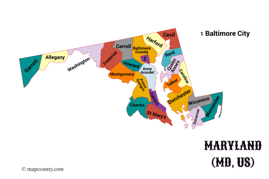
Maryland County Map with Cities and Towns [MD, US]
Maryland’s 23 counties and Baltimore City form 24 county-level units, shown with seats, cities, towns and geographic context.
Maryland’s 23 counties and Baltimore City form 24 county-level units, shown with seats, cities, towns and geographic context.
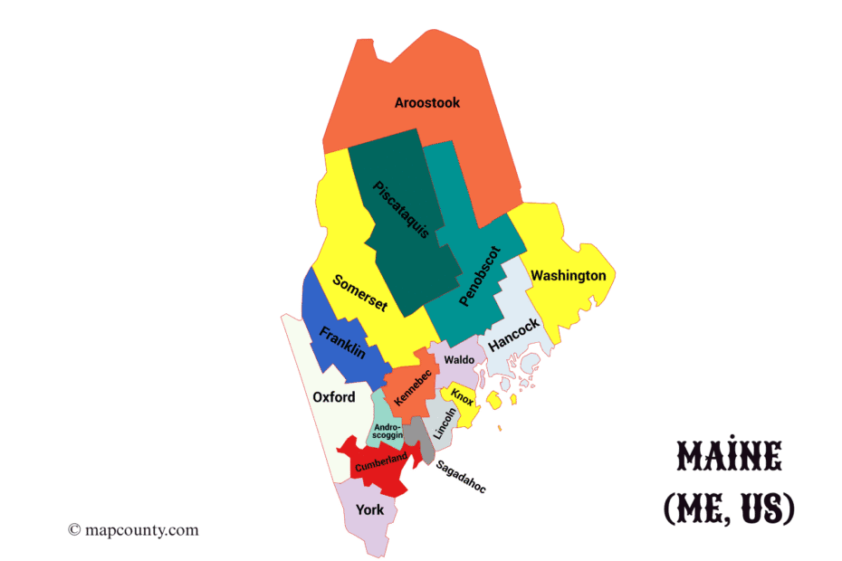
Maine’s 16 counties are compared by seat, land area, water area, total area and principal communities for accurate map reference.
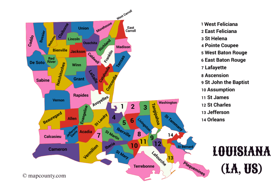
Louisiana’s 64 parishes are listed with parish seats, founding dates, areas and notable towns for county-equivalent map reference.
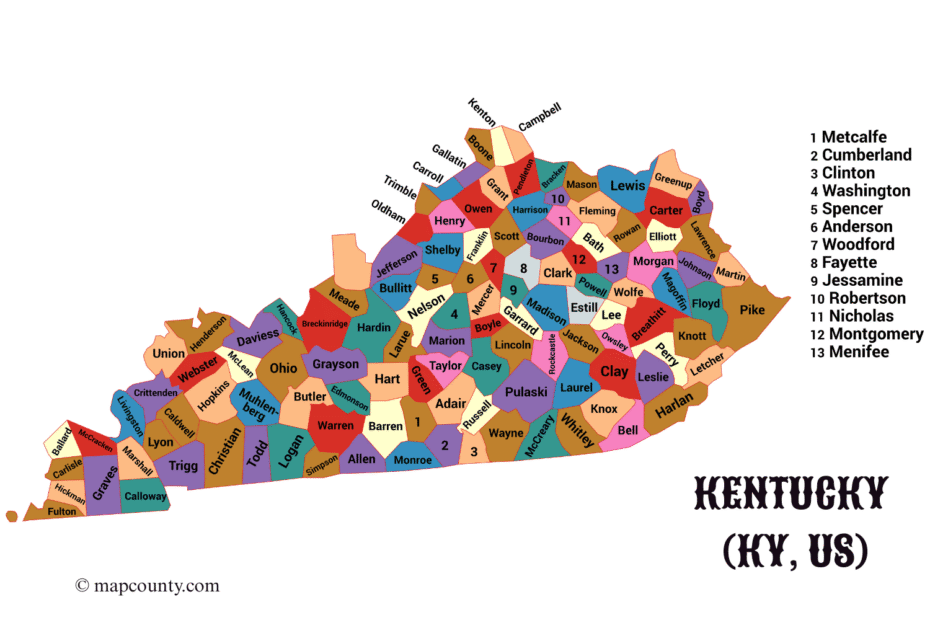
Kentucky’s 120 counties are arranged with seats, cities, towns and regional context for statewide comparison across the Bluegrass State.
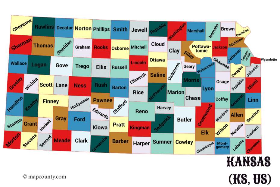
Kansas’s 105 counties are paired with seats, historical details, area figures and major cities and towns across prairie regions.
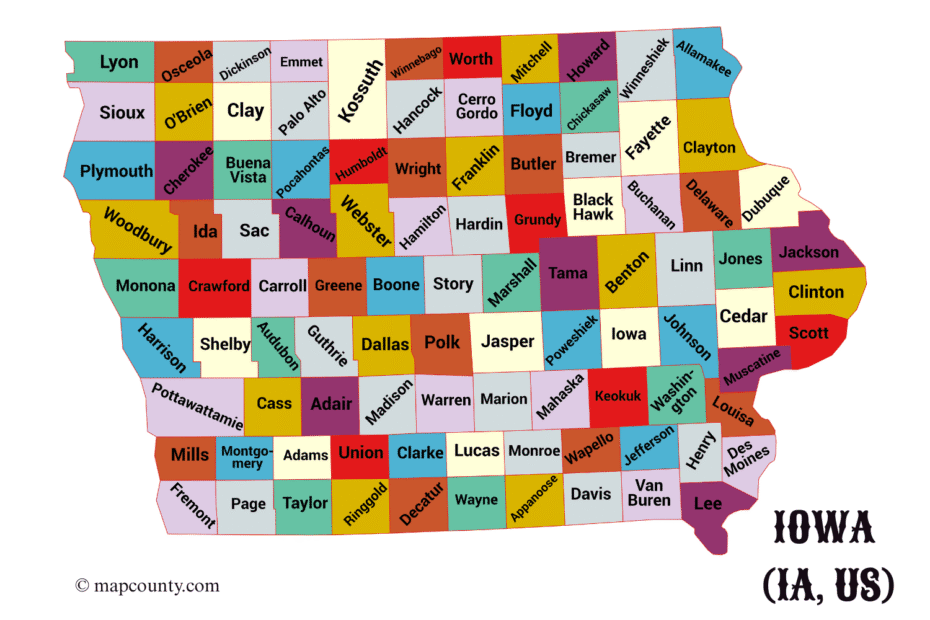
Iowa’s 99 counties appear with seats, dates, areas and major communities in a compact local-geography reference.
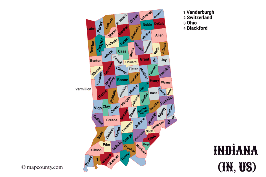
Indiana’s 92 counties are organized by seat, establishment date, area and notable towns for map-based and local geographic lookup.
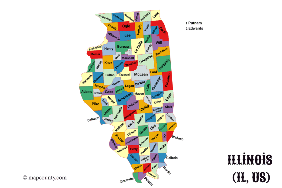
Illinois’s 102 counties are listed with seats, established dates, area details and selected cities and towns for statewide reference.
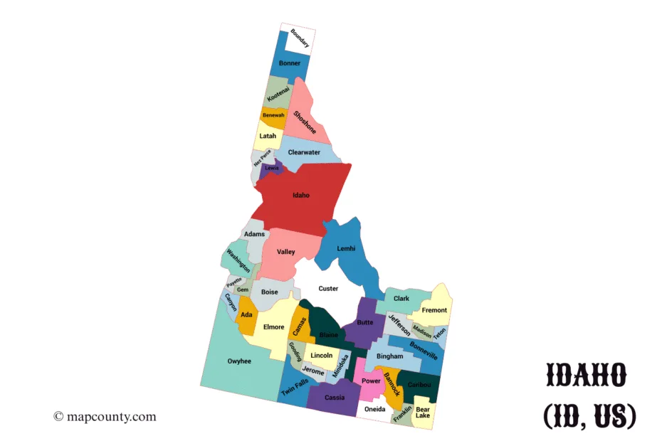
Idaho County is profiled through Grangeville, Riggins, Kooskia and other towns, with settlement history and river geography.
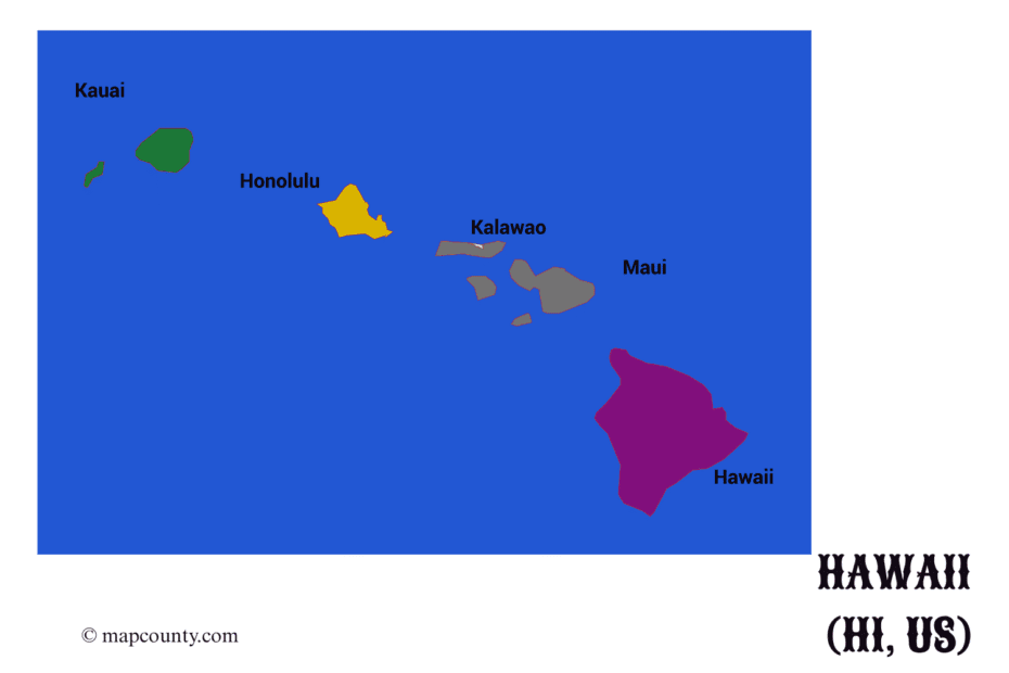
Hawaii’s five counties are listed with seats, dates, areas and major communities, followed by geographic and cultural context.
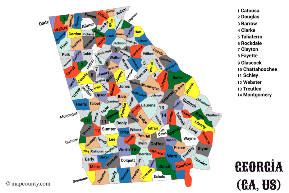
Georgia’s 159 counties are mapped with seats, cities, towns and local geography across the state’s extensive county system.
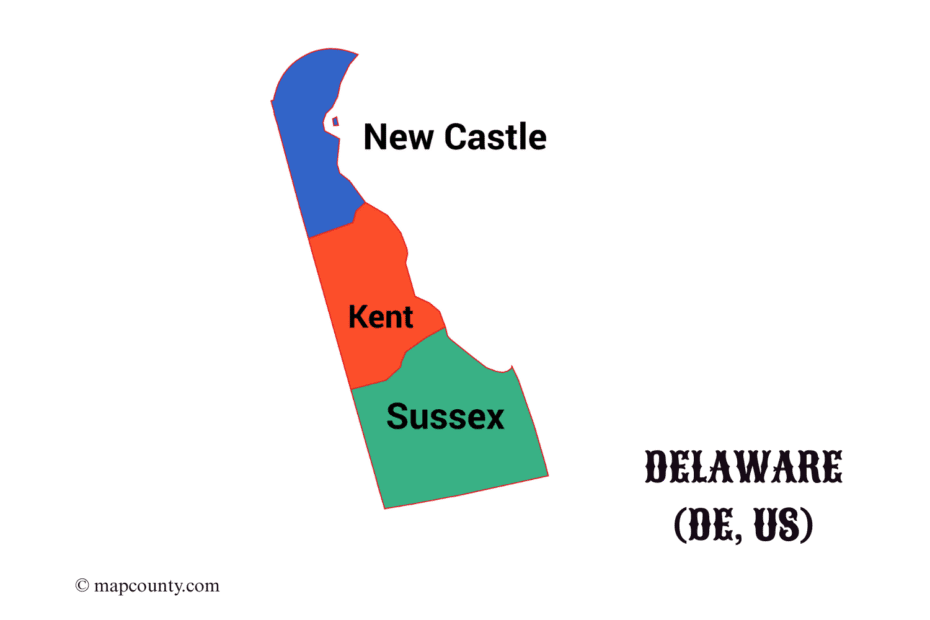
Delaware’s three counties—New Castle, Kent and Sussex—are shown with seats, dates, areas, cities and government context.
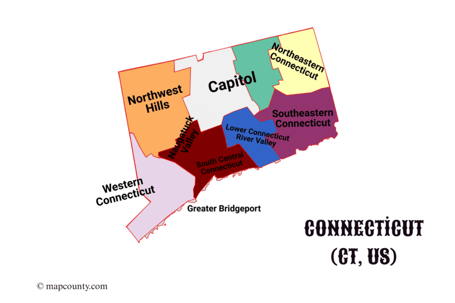
Connecticut’s map separates nine current planning regions from eight historic counties and states which system current Census data uses.
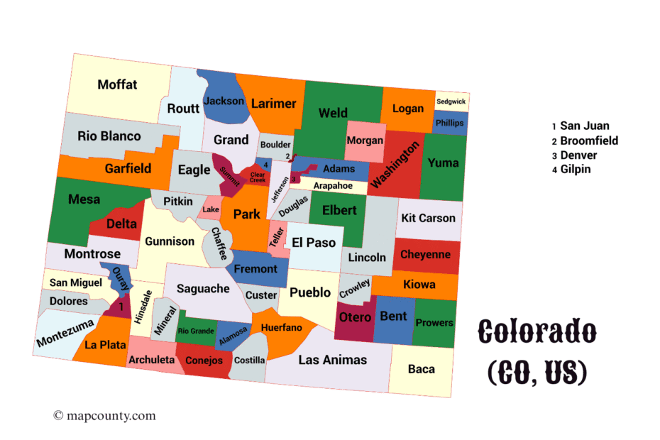
Colorado’s 64 counties are shown with seats, cities, towns and geography spanning the plains, Rocky Mountains and western plateaus.
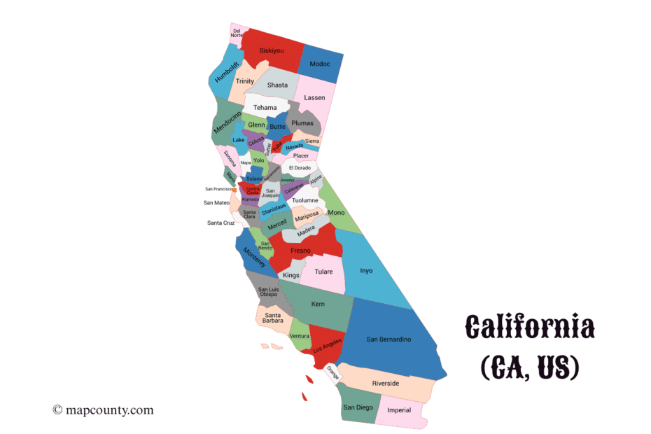
California’s 58 counties are arranged with seats, cities, towns and regional context from northern forests to southern coasts.
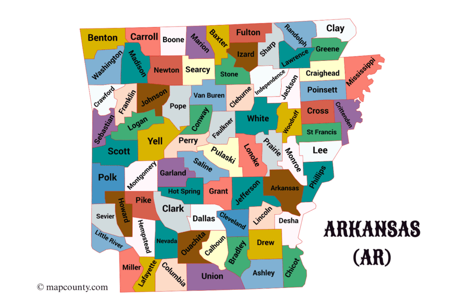
Arkansas has 75 counties; the page pairs boundaries with seats, cities, towns, dates, areas and regional geography.
Alaska’s 30 county equivalents comprise 19 borough governments and 11 census areas, with current names and GEOIDs.
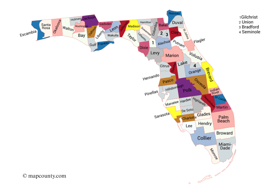
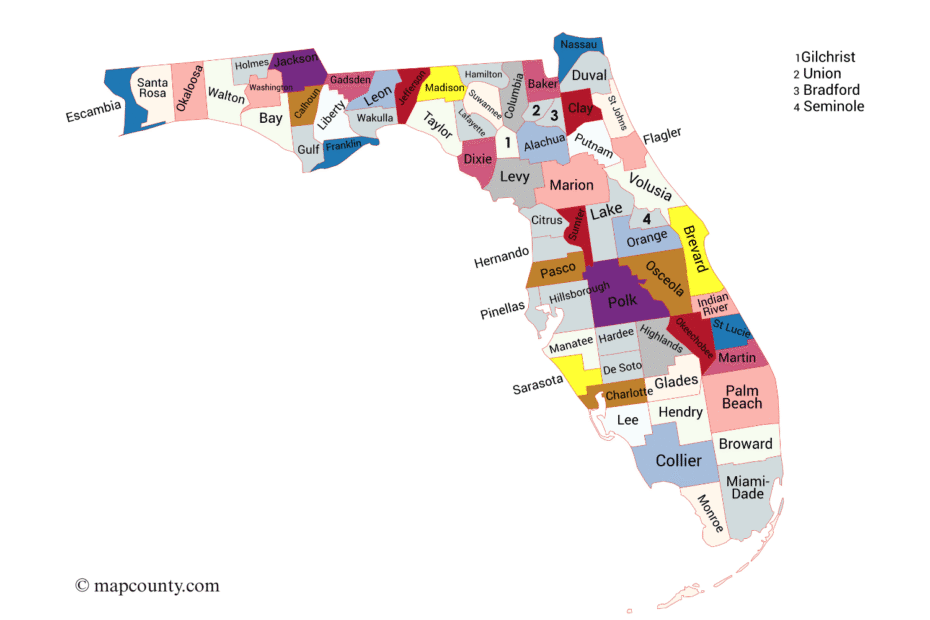
Florida’s 67 counties are shown with county seats, formation details, area figures and principal cities and towns across the state.
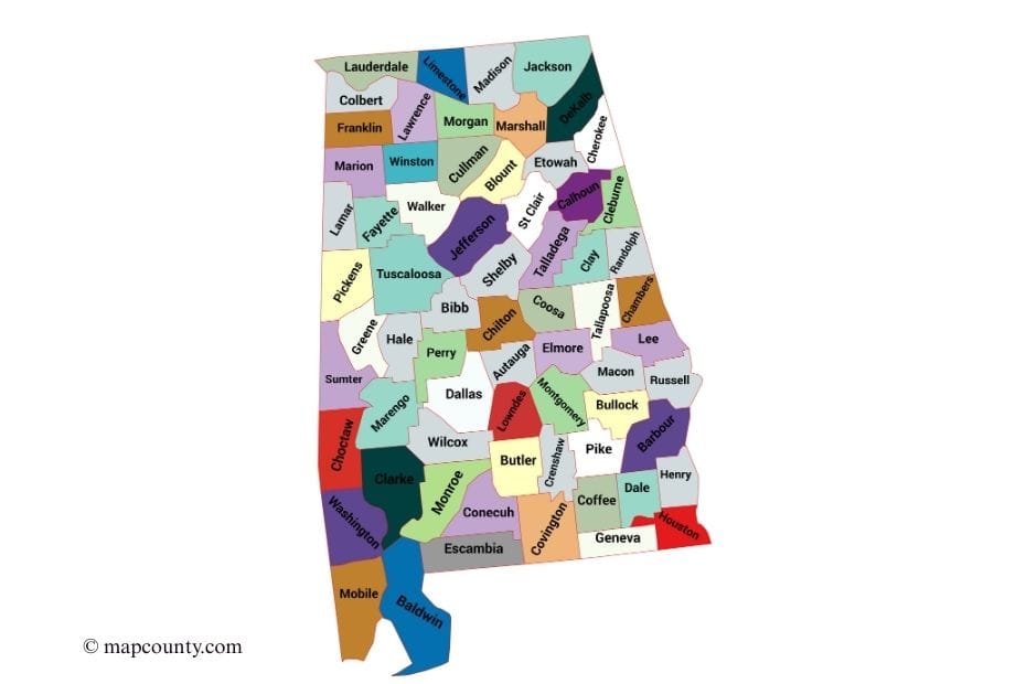
Alabama’s 67 counties are listed with seats, establishment details, area data and major cities and towns for statewide lookup.
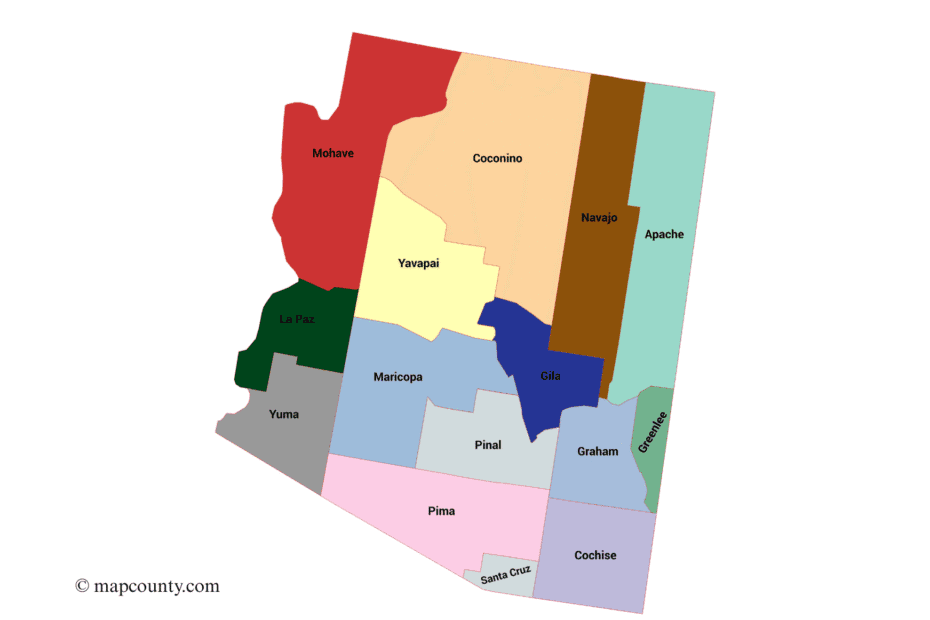
Arizona’s 15 counties are mapped with seats, cities, towns and regional patterns, including the Phoenix and Tucson metro areas.