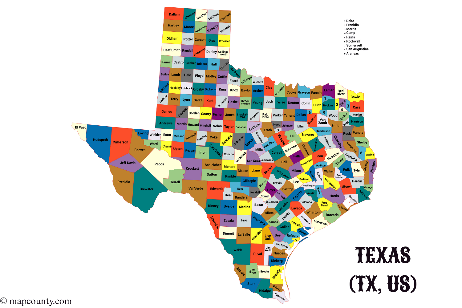
Texas is organized into 254 counties. If you work with addresses, maps, statistics, or local place names, counties show up everywhere. This page gives you a clean reference list plus a few quick ways to use it.
Each row includes the county seat, a FIPS identifier, the established year, and area in square miles. FIPS is handy when you merge datasets from different sources.
Small note: a county seat is the main administrative town where many county offices keep their adress.
Counties
254
State FIPS prefix
48
Seats sharing the county name
43
Largest county by area
Brewster County
Smallest county by area
Rockwall County
Newest county created
Kenedy County (1921)
Complete list of Texas counties
Tip for copy and paste: FIPS values are already in the five digit Texas format.
How to read the table
- County is the county name used in most datasets and forms.
- County seat is the main administrative town for that county.
- FIPS shown here is the five digit county code for Texas, built as 48 plus the county three digit code.
- Established is the year the county was created.
- Area sq mi is a stable geography field that works well for comparisons.
Fast comparisons using stable fields
Largest counties by area
| County | County seat | Area sq mi | Established | FIPS |
|---|---|---|---|---|
| Brewster County | Alpine | 6,193 | 1887 | 48043 |
| Pecos County | Fort Stockton | 4,764 | 1871 | 48371 |
| Hudspeth County | Sierra Blanca | 4,571 | 1917 | 48229 |
| Presidio County | Marfa | 3,856 | 1850 | 48377 |
| Culberson County | Van Horn | 3,813 | 1911 | 48109 |
| Webb County | Laredo | 3,357 | 1848 | 48479 |
| Val Verde County | Del Rio | 3,171 | 1885 | 48465 |
| Crockett County | Ozona | 2,808 | 1875 | 48105 |
| Reeves County | Pecos | 2,636 | 1883 | 48389 |
| Terrell County | Sanderson | 2,358 | 1905 | 48443 |
Smallest counties by area
| County | County seat | Area sq mi | Established | FIPS |
|---|---|---|---|---|
| Rockwall County | Rockwall | 149 | 1873 | 48397 |
| Somervell County | Glen Rose | 187 | 1875 | 48425 |
| Camp County | Pittsburg | 198 | 1874 | 48063 |
| Aransas County | Rockport | 252 | 1871 | 48007 |
| Morris County | Daingerfield | 254 | 1875 | 48343 |
| Rains County | Emory | 259 | 1870 | 48379 |
| Gregg County | Longview | 274 | 1873 | 48183 |
| Delta County | Cooper | 277 | 1870 | 48119 |
| Franklin County | Mount Vernon | 286 | 1875 | 48159 |
| Orange County | Orange | 356 | 1852 | 48361 |
County creation by decade
This view helps when you bucket counties by time periods for analysis or navigation filters.
Practical workflows for data and lookup
- Sorting: sort by county name to match most alphabetical directories.
- Joining datasets: join on FIPS when spelling differences show up.
- Mapping: use area to sanity check outliers and detect mis-matched rows.
- Address forms: county seat helps when a form asks for a courthouse city or county office location.
Matching county names without surprises
County names can vary across files. Some differences are spacing, abbreviations, or small punctuation in a few places. When accuracy matters, use FIPS as the join key and keep the county name as a display field.
FIPS in one sentence and why it helps
FIPS is a compact code used across many official datasets; for Texas counties it starts with 48, then adds a three digit county code, forming a five digit value like 48029 for Bexar County.
Regional labels people use in Texas
Texas is often described with informal regional names. They are useful as tags, filters, or summary groupings.
Glossary
- County: a local subdivision used for administration, records, and many geographic datasets.
- County seat: the primary administrative town for the county.
- FIPS: a standardized numeric identifier used to match locations across datasets.
- Square mile: a common area unit used in U.S. geographic tables.