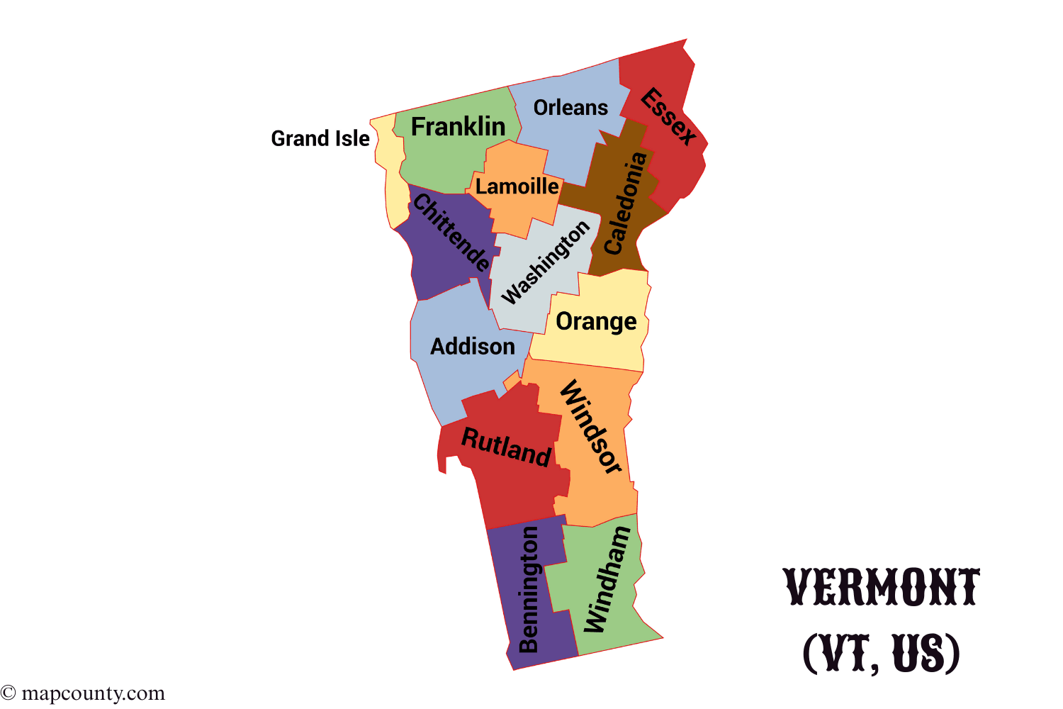
Vermont Counties And Shire Towns
Vermont is split into 14 counties. Counties help with records, courts, and regional planning, while everyday services often run through towns and cities. Vermont also uses the term shire town for the county seat.
| County | Shire Town | Established | Area (sq mi) | Population (2020) | FIPS |
|---|---|---|---|---|---|
| Addison | Middlebury | Oct 18, 1785 | 770 | 38,047 | 50001 |
| Bennington | Bennington and Manchester | Feb 11, 1779 | 676 | 37,039 | 50003 |
| Caledonia | St. Johnsbury | Nov 5, 1792 | 651 | 30,535 | 50005 |
| Chittenden | Burlington | Oct 22, 1787 | 539 | 170,851 | 50007 |
| Essex | Guildhall | Nov 5, 1792 | 665 | 6,037 | 50009 |
| Franklin | St. Albans | Nov 5, 1792 | 637 | 51,066 | 50011 |
| Grand Isle | North Hero | Nov 9, 1802 | 83 | 7,528 | 50013 |
| Lamoille | Hyde Park | Oct 26, 1835 | 461 | 26,248 | 50015 |
| Orange | Chelsea | Feb 22, 1781 | 689 | 30,050 | 50017 |
| Orleans | Newport | Nov 5, 1792 | 697 | 27,726 | 50019 |
| Rutland | Rutland | Feb 22, 1781 | 932 | 60,198 | 50021 |
| Washington | Montpelier | Nov 1, 1810 | 690 | 59,844 | 50023 |
| Windham | Newfane | Feb 22, 1779 | 789 | 45,627 | 50025 |
| Windsor | Woodstock | Feb 22, 1781 | 971 | 57,697 | 50027 |
Quick County Snapshot
- Largest By Area: Windsor at 971 sq mi
- Smallest By Area: Grand Isle at 83 sq mi
- Most Populated: Chittenden at 170,851
- Least Populated: Essex at 6,037
How Counties Fit Into Vermont Life
Think of a Vermont county as a regional label that helps organize certain functions. Towns and cities handle many day to day services. Counties still matter, especially when you need something that is countywide or tied to official records.
Common Reasons People Use Counties
- Court Locations and hearing venues
- Land And Property Records by jurisdiction
- Regional Planning and statistical comparisons
- Mailing Context when a place name repeats in neigboring areas
What A Shire Town Usually Offers
- Courthouse and related offices
- County level record access points
- Central meeting spots for multi town services
- Local history and archival hubs in many counties
Find A County From Any Vermont Place
If you start with a town or city name and need the county, a simple routine keeps it clean and fast.
- Confirm The Place Type: city, town, village, gore, or unincorporated area
- Match It To A County: Vermont counties cover the full state area, even where population is tiny
- Use The FIPS Code if you work with datasets or GIS files
Data Tip That Saves Time
FIPS codes are stable identifiers for counties. They are handy when names are spelled differently across spreadsheets. If you merge datasets, matching by 50001 to 50027 is defintely smoother than matching text labels.
Regional Patterns Across Vermont
County borders do not always match how people describe regions, yet the overlap is useful for planning and comparison. The groupings below are practical, not rigid.
| Region Label | Counties Commonly Included | What Stands Out |
|---|---|---|
| Champlain Valley | Addison, Chittenden, Franklin, Grand Isle | Lake corridor, larger population centers, cross county commuting |
| Northeast Kingdom | Caledonia, Essex, Orleans | Big land area, smaller population, wide spacing between hubs |
| Central Green Mountain Belt | Lamoille, Washington | Mountain routes, valleys that guide travel north and south |
| Connecticut River Side | Orange, Windsor | River valley towns, east side travel links and services |
| Southern Counties | Bennington, Windham, Rutland | Multiple gateway towns, a mix of small cities and rural areas |
County Scale Stats Worth Knowing
These quick stats help you read the county table with the right expectations.
- Area Range: from 83 sq mi in Grand Isle to 971 sq mi in Windsor
- Population Range: from 6,037 in Essex to 170,851 in Chittenden
- Service Geography: larger counties can mean longer drives to a shire town, even inside one county
- Local Identity: many residents talk in town names first, then county names when needed
Mini Chart (Area Leaders)
Windsor 971 sq mi
Rutland 932 sq mi
Windham 789 sq mi
Addison 770 sq mi
Vermont Basics Beyond Counties
Once you know the county, a few statewide facts help with context.
- State Capital: Montpelier
- Largest City: Burlington
- Landscape: a mix of Green Mountains, river valleys, and Lake Champlain shoreline
- Local Structure: towns are central to services, community decisions, and identity
More USA County Maps
- South Dakota County Map with Cities and Towns [SD, US]
- South Carolina County Map with Cities and Towns [SC, US]
- North Carolina County Map with Cities and Towns [NC, US]
- North Dakota County Map with Cities and Towns [ND, US]
- Wyoming County Map with Cities and Towns [WY, US]
- Wisconsin County Map with Cities and Towns [WI, US]