Virginia County Directory With Seats and FIPS Codes
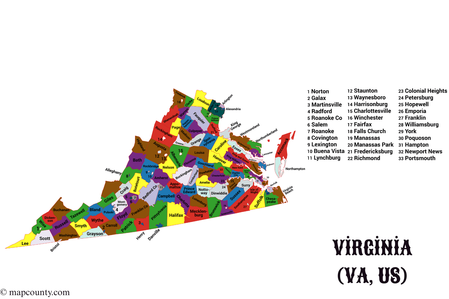
Virginia organizes local geography through counties and independent cities. If you are used to provinces (il) and districts (ilçe), a county is the cleanest comparison: a practical unit for records, services, and data. The directory below lists every Virginia county with its county seat, year formed, and the county FIPS code used across many public datasets.
| County | County Seat | Formed | County FIPS |
|---|---|---|---|
| Accomack County | Accomac | 1663 | 001 |
| Albemarle County | Charlottesville | 1744 | 003 |
| Alleghany County | Covington | 1822 | 005 |
| Amelia County | Amelia Court House | 1735 | 007 |
| Amherst County | Amherst | 1761 | 009 |
| Appomattox County | Appomattox | 1845 | 011 |
| Arlington County | Arlington | 1846 | 013 |
| Augusta County | Staunton | 1738 | 015 |
| Bath County | Warm Springs | 1791 | 017 |
| Bedford County | Bedford | 1754 | 019 |
| Bland County | Bland | 1861 | 021 |
| Botetourt County | Fincastle | 1770 | 023 |
| Brunswick County | Lawrenceville | 1720 | 025 |
| Buchanan County | Grundy | 1858 | 027 |
| Buckingham County | Buckingham | 1761 | 029 |
| Campbell County | Rustburg | 1782 | 031 |
| Caroline County | Bowling Green | 1728 | 033 |
| Carroll County | Hillsville | 1842 | 035 |
| Charles City County | Charles City | 1634 | 036 |
| Charlotte County | Charlotte Court House | 1765 | 037 |
| Chesterfield County | Chesterfield | 1749 | 041 |
| Clarke County | Berryville | 1836 | 043 |
| Craig County | New Castle | 1851 | 045 |
| Culpeper County | Culpeper | 1749 | 047 |
| Cumberland County | Cumberland | 1749 | 049 |
| Dickenson County | Clintwood | 1880 | 051 |
| Dinwiddie County | Dinwiddie | 1752 | 053 |
| Essex County | Tappahannock | 1692 | 057 |
| Fairfax County | Fairfax | 1742 | 059 |
| Fauquier County | Warrenton | 1759 | 061 |
| Floyd County | Floyd | 1831 | 063 |
| Fluvanna County | Palmyra | 1777 | 065 |
| Franklin County | Rocky Mount | 1786 | 067 |
| Frederick County | Winchester | 1738 | 069 |
| Giles County | Pearisburg | 1806 | 071 |
| Gloucester County | Gloucester | 1651 | 073 |
| Goochland County | Goochland | 1728 | 075 |
| Grayson County | Independence | 1793 | 077 |
| Greene County | Stanardsville | 1838 | 079 |
| Greensville County | Emporia | 1781 | 081 |
| Halifax County | Halifax | 1752 | 083 |
| Hanover County | Hanover | 1721 | 085 |
| Henrico County | Richmond | 1617 | 087 |
| Henry County | Martinsville | 1777 | 089 |
| Highland County | Monterey | 1847 | 091 |
| Isle of Wight County | Isle of Wight | 1634 | 093 |
| James City County | Williamsburg | 1617 | 095 |
| King and Queen County | King and Queen Court House | 1691 | 097 |
| King George County | King George | 1721 | 099 |
| King William County | King William | 1702 | 101 |
| Lancaster County | Lancaster | 1651 | 103 |
| Lee County | Jonesville | 1793 | 105 |
| Loudoun County | Leesburg | 1757 | 107 |
| Louisa County | Louisa | 1742 | 109 |
| Lunenburg County | Lunenburg | 1746 | 111 |
| Madison County | Madison | 1793 | 113 |
| Mathews County | Mathews | 1791 | 115 |
| Mecklenburg County | Boydton | 1765 | 117 |
| Middlesex County | Saluda | 1673 | 119 |
| Montgomery County | Christiansburg | 1777 | 121 |
| Nelson County | Lovingston | 1808 | 125 |
| New Kent County | New Kent | 1654 | 127 |
| Northampton County | Eastville | 1634 | 131 |
| Northumberland County | Heathsville | 1648 | 133 |
| Nottoway County | Nottoway | 1789 | 135 |
| Orange County | Orange | 1734 | 137 |
| Page County | Luray | 1831 | 139 |
| Patrick County | Stuart | 1791 | 141 |
| Pittsylvania County | Chatham | 1767 | 143 |
| Powhatan County | Powhatan | 1777 | 145 |
| Prince Edward County | Farmville | 1754 | 147 |
| Prince George County | Prince George | 1703 | 149 |
| Prince William County | Manassas | 1731 | 153 |
| Pulaski County | Pulaski | 1839 | 155 |
| Rappahannock County | Washington | 1833 | 157 |
| Richmond County | Warsaw | 1692 | 159 |
| Roanoke County | Salem | 1838 | 161 |
| Rockbridge County | Lexington | 1778 | 163 |
| Rockingham County | Harrisonburg | 1778 | 165 |
| Russell County | Lebanon | 1786 | 167 |
| Scott County | Gate City | 1814 | 169 |
| Shenandoah County | Woodstock | 1772 | 171 |
| Smyth County | Marion | 1832 | 173 |
| Southampton County | Courtland | 1749 | 175 |
| Spotsylvania County | Spotsylvania Courthouse | 1721 | 177 |
| Stafford County | Stafford | 1664 | 179 |
| Surry County | Surry | 1652 | 181 |
| Sussex County | Sussex | 1754 | 183 |
| Tazewell County | Tazewell | 1800 | 185 |
| Warren County | Front Royal | 1836 | 187 |
| Washington County | Abingdon | 1777 | 191 |
| Westmoreland County | Montross | 1653 | 193 |
| Wise County | Wise | 1856 | 195 |
| Wythe County | Wytheville | 1790 | 197 |
| York County | Yorktown | 1634 | 199 |
Friendly Detail
In Virginia, a county seat can be located inside an independent city. The city and the county remain seperated localities for administration and statistics, even when the names look similar.
How Counties Work In Virginia
A county is a local area that helps organize everyday things like public records, services, and boundaries. People often use county names as a shortcut for location, yet the county also matters when you need consistency in data.
- County seat is the main administrative location for county level offices.
- Towns sit within counties and share some services with the county.
- Independent cities operate at the same broad level as counties for many statistical uses.
- Unincorporated communities are places without their own town or city government, still inside a county.
Reading FIPS Codes Without Stress
FIPS codes are short numbers used to identify places in a consistent way. If you work with spreadsheets, maps, or APIs, this little code is often the fastest way to match records cleanly.
- Use the 3 digit county code from the table when a dataset is Virginia only.
- Use the 5 digit full code when you combine multiple states.
- Keep the leading zeros. For example, 001 is not the same as 1.
| Code Type | Example | What It Identifies |
|---|---|---|
| State FIPS | 51 | Virginia |
| County FIPS | 059 | Fairfax County within Virginia |
| Full 5 Digit FIPS | 51059 | Virginia plus Fairfax County |
Independent Cities and County Seats
Virginia is well known for its independent city structure. A city is not inside a county, even if it is surrounded by one. This is why you may see a county seat listed as a city name. It matters when you sort addresses or match datasets.
| Locality Type | Simple Meaning | Typical Use |
|---|---|---|
| County | Primary local area unit | Records, services, county wide mapping |
| Independent City | City treated like a county for many stats | City services, city boundaries, city level data |
| Town | Incorporated place inside a county | Local identity, local services that work with the county |
Virginia Regions Often Used In County Research
Counties are official units. Regions are informal, yet they help you think spatially. When you filter a list, these broad labels can cut your time in half.
- Northern Virginia for dense suburban counties near the national capital area.
- Shenandoah Valley for counties aligned with the valley corridor and mountain ridges.
- Piedmont for rolling landscapes between the mountains and coastal plain.
- Tidewater and Hampton Roads for coastal counties and large port metro areas.
- Southside for counties along the southern band of the state.
- Southwest for Appalachian counties with strong ridge and valley geography.
- Eastern Shore for the peninsula counties across Chesapeake Bay.
Practical Ways To Use County Information
Once you know the county, your search becomes sharper. The trick is to choose a stable identifier, then keep it consistent across everything you collect.
- For addresses and mailing lists: store both county name and FIPS so merges are painless.
- For mapping: match boundary files by the county FIPS rather than by spelling.
- For research notes: record the county seat since many county level offices are located there.
- For trip planning: use counties to group nearby towns and natural areas without jumping between unrelated places.
Common County Level Fields In Datasets
- County Name plus a normalized version for sorting
- County FIPS (3 digit within Virginia or 5 digit full code)
- Seat or administrative center
- Land Area and Water Area when the dataset supports geography
- Population and Housing when the dataset tracks demographics
Virginia Overview Beyond Counties
Virginia sits on the U.S. East Coast and is often described as a bridge between the Mid Atlantic and the Southeast. The state includes coastal plains, river systems, rolling uplands, and mountain ridges. That variety explains why county sizes, shapes, and settlement patterns feel different from one region to the next.
Quick Numbers
- 95 counties
- 38 independent cities often treated as county equivalents for statistics
- 51 is the state FIPS code used in many data systems
County First Keywords
- Virginia counties
- county seats
- FIPS codes
- cities and counties
- localities
More USA County Maps
- South Dakota County Map with Cities and Towns [SD, US]
- South Carolina County Map with Cities and Towns [SC, US]
- North Carolina County Map with Cities and Towns [NC, US]
- North Dakota County Map with Cities and Towns [ND, US]
- Wyoming County Map with Cities and Towns [WY, US]
- Wisconsin County Map with Cities and Towns [WI, US]